Setting out mistakes are site layout errors that place design positions, levels, gridlines, or coordinates in the wrong physical location. In construction, these errors can affect foundations, drainage, steelwork, walls, utilities, and internal layouts, which is why accurate setting out services are important from the early stages of a project. A small error in control, measurement, level, or information transfer can move a constructed element away from the approved design, triggering rework, programme delays, and cost overruns.
Accurate setting out connects design information with real site conditions. A drawing may show the correct foundation line, drainage route, bolt position, or wall layout, but the project only benefits when that information is transferred to site accurately.
The Get It Right Initiative states that construction errors cost the UK industry billions every year. The annual spend caused by error is estimated at around seven times the total annual profit of the UK construction industry.
What Are the Most Common Setting Out Mistakes?
The most common setting out mistakes are using outdated drawings, working from unverified control points, setting incorrect datum levels, using uncalibrated instruments, misreading dimensions, and failing to document QA checks.
These mistakes usually occur before the construction element is built. A wrong line, peg, level, or coordinate may appear minor at first, but the impact can carry through excavation, foundations, drainage, concrete works, steel installation, cladding, partitions, and services.
Setting out errors are not purely a surveying issue. They are a project coordination issue. The mistake can originate from a design revision, an incorrect drawing file, a disturbed control point, a wrong prism height, or a poor information handover between site teams.
Why Do Setting Out Mistakes Cause Construction Rework?
Setting out mistakes cause construction rework because incorrect site positions convert design information into wrongly built construction work.
A misplaced gridline can affect foundation positions. An incorrect level can affect drainage falls. A wrong offset can affect wall alignment. A misread coordinate can affect pile positions, service routes, and steel frame connections.
Rework costs more than the original task because labour, plant, materials, inspections, and programme time are all repeated. In many cases, the error also affects connected trades. An incorrectly positioned structural opening can delay glazing installation, MEP coordination, internal finishes, and project handover.
Prevention depends on a complete verification chain: from design information through survey control, instrument setup, field marking, independent check, and as-built review. A single final check is not sufficient.
How Do Outdated Drawings Create Setting Out Errors?
Outdated drawings create setting out errors when site teams use superseded design information instead of the latest issued construction drawings.
Construction drawings change throughout design coordination. Architects, structural engineers, civil engineers, MEP consultants, and contractors update gridlines, dimensions, slab edges, drainage layouts, service routes, and foundation details during the design process. If the setting out engineer works from an old revision, the site marking may be dimensionally accurate — but accurate to the wrong document.
A drawing register reduces this risk. The register records the latest revision number, issue date, drawing number, discipline, and approval status. Site teams can confirm whether the drawing is issued for construction, coordination, tender, or information only.
The setting out process must begin from the latest approved drawing package. This includes plans, sections, levels, specifications, coordinates, grid references, and any design change notices affecting the work area.
How Do Survey Control Errors Affect Site Setting Out?
Survey control errors affect site setting out by moving every subsequent measurement away from the correct site reference system.
Survey control points are fixed reference positions used to locate construction elements. These points connect site work to coordinates, gridlines, benchmarks, and datum levels. If a control point is disturbed, incorrectly identified, or left unchecked, every line and level taken from that control can become unreliable.
Control errors are particularly serious because they repeat across the site. A wrong benchmark can affect drainage levels across an entire run. A wrong coordinate system can offset multiple foundation positions. A disturbed control station can affect structural grids, external works, and utility routes simultaneously.
UK construction projects may use a site grid, local grid, project grid, or Ordnance Survey National Grid reference system. The setting out team must confirm which grid system applies before work begins. Mixing grid systems can place accurate field measurements in the wrong physical location.
A reliable control process verifies primary control, checks secondary control, confirms datum levels, records all coordinates, and protects control stations from site traffic, excavation, and plant movement throughout the project.
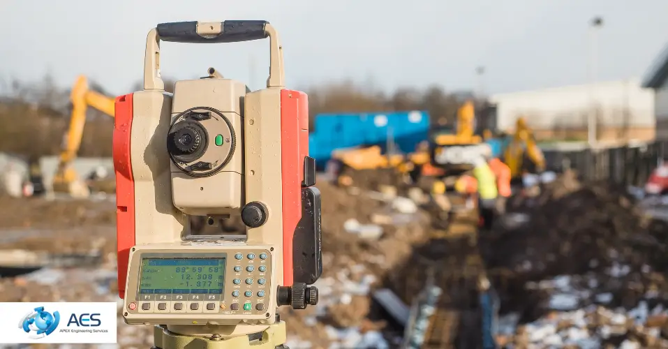
What Causes Total Station Setting Out Errors?
Total station setting out errors arise from incorrect instrument setup, poor backsight verification, wrong prism height entry, unconfirmed station coordinates, or calibration drift.
A total station measures angles and distances to locate design points on site. The instrument depends entirely on correct setup. If the setup is wrong, every measurement that follows is wrong before the first point is marked.
Common total station problems include incorrect instrument height, wrong prism height, incorrect prism constant, obstructed line of sight, wrong control station selection, and missed backsight confirmation. The field controller may also contain an outdated coordinate file, an incorrect coordinate system, or a superseded design dataset.
The correct process runs in three stages. First, confirm the station position and backsight against verified control. Second, confirm that known control points return expected coordinates or levels within tolerance. Third, compare each marked point against the drawing dimension and stated tolerance before construction proceeds.
What Causes GNSS Setting Out Errors?
GNSS setting out errors occur when satellite positioning is degraded by weak correction signals, site obstructions, multipath interference, poor control tie-in, or unfavourable site geometry.
GNSS is effective for many external construction and civil engineering tasks, particularly across open or large-area sites where fast coordinate positioning is needed. However, GNSS accuracy depends on clear satellite visibility, reliable correction data from an active network or base station, compatible control points, and appropriate site conditions.