
Utility Surveys (PAS 128 Standard)
Our Utility Surveys provide accurate and comprehensive mapping of underground and above-ground utilities, ensuring a reliable safeguard against costly project delays and unexpected financial setbacks. Conducted by QCF Level 3-trained professionals, our surveys are designed to give clients a detailed understanding of infrastructure across their project sites, helping to mitigate risks and improve planning efficiency. By following the PAS 128 standard for utility mapping, we deliver high-quality, reliable data that supports construction, infrastructure development, and maintenance projects.
Why Choose Our Utility Surveys?
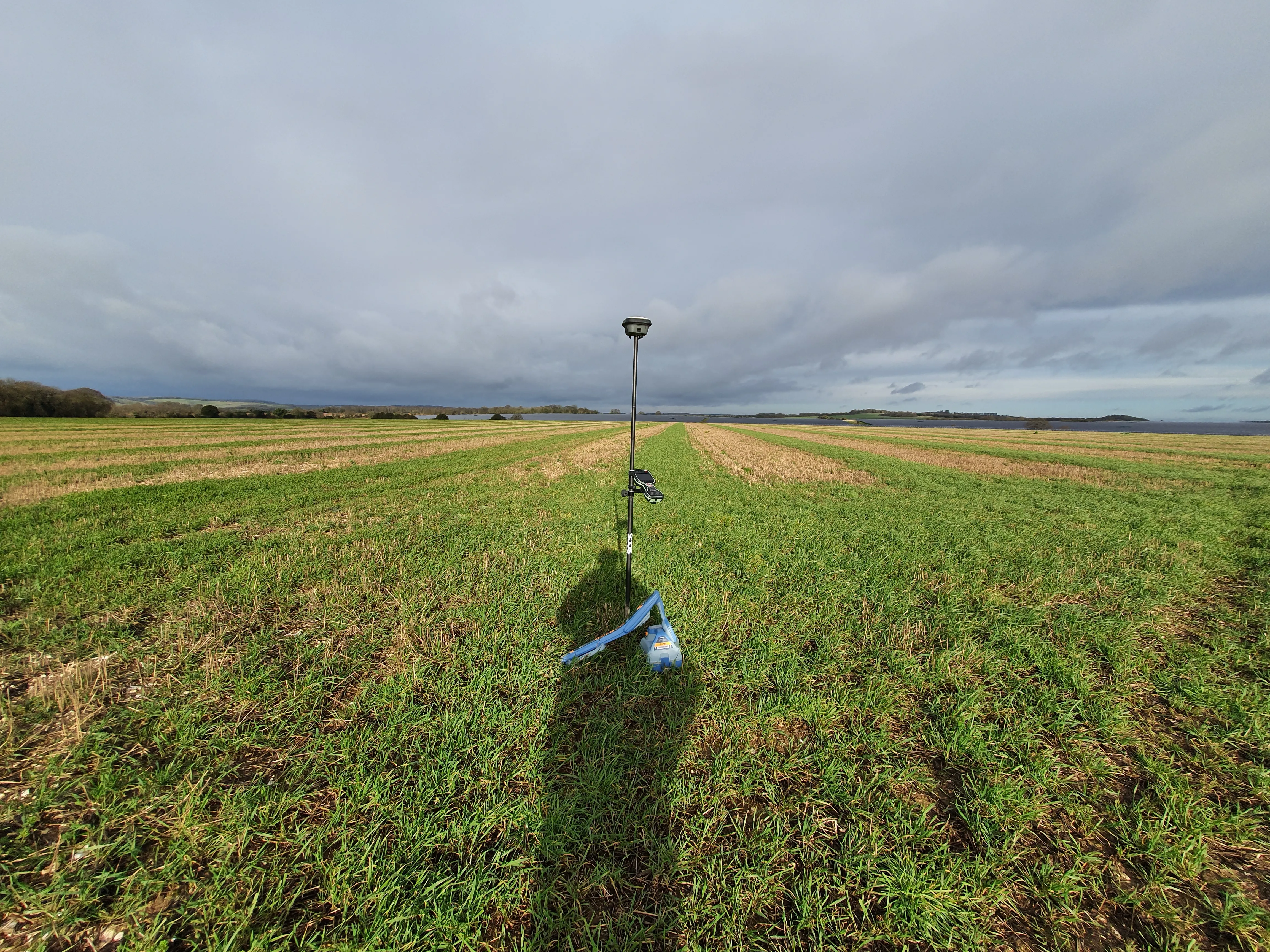
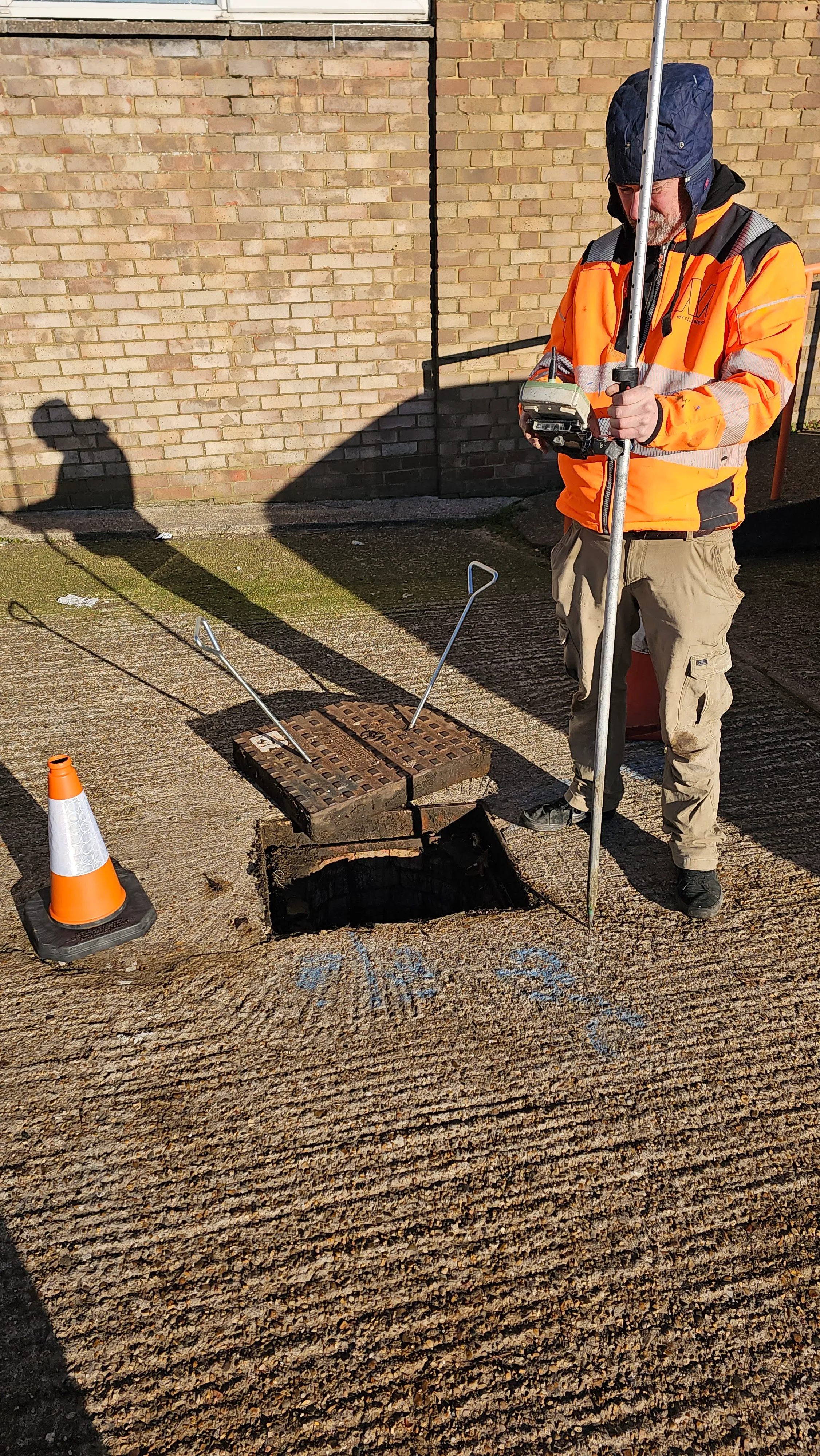
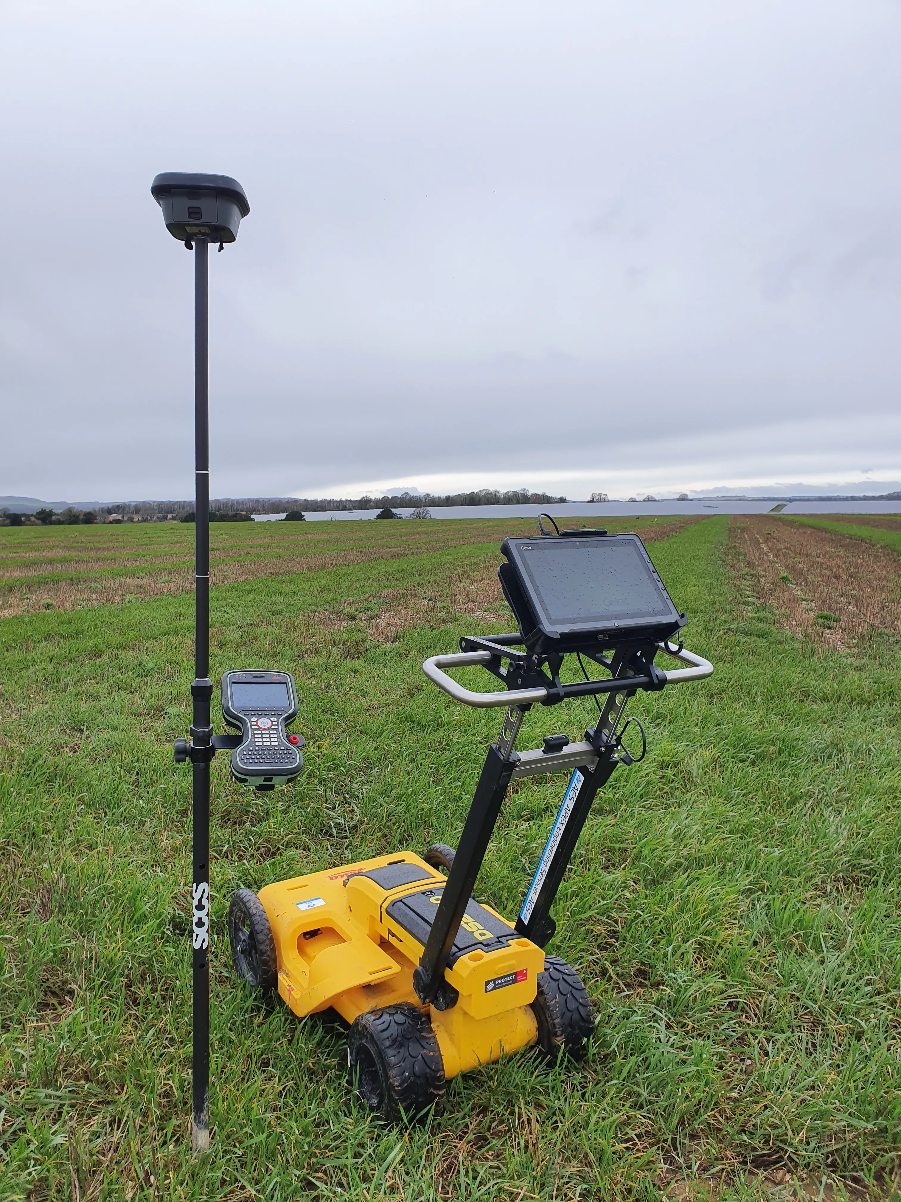
Our utility surveys offer a thorough approach to identifying and locating essential utilities, from electricity and telecom cables to gas, water, and sewer lines. We utilise advanced techniques and equipment, including radio detection and manhole lifting, to ensure that clients receive an accurate, up-to-date representation of the utilities present on-site. Key benefits include:
- Reduced Project Risks: Accurate utility mapping reduces the risk of accidental strikes and unplanned disruptions during excavation or construction.
- Trained and Experienced Operatives: Our QCF Level 3-trained team brings expertise in utility mapping, utility location, and cable avoidance, ensuring reliable results.
- Comprehensive Data for Informed Decision-Making: Our surveys provide both above- and below-ground data, supporting effective project planning and execution.
Comprehensive Utility Mapping for Complete Site Awareness
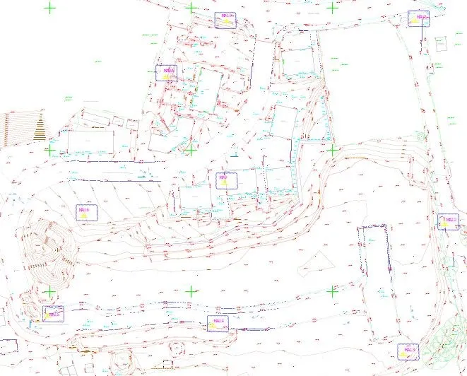
Our utility mapping services provide a clear and detailed picture of existing infrastructure, including the detection and tracing of electricity, telecoms, cable TV, water and sewer pipes, and gas lines. Our surveys are tailored to meet each client’s unique project needs, combining topographical surveys with precise utility location techniques for a better understanding of the service layout. We use cutting-edge technology to detect and trace various underground services, helping clients plan safely and efficiently.
Key Elements of Our Utility Surveys
Our utility surveys encompass a range of essential elements to ensure a complete understanding of on-site utilities, including:
- Site Investigation: Comprehensive on-site assessments to identify and map existing utility networks accurately.
- Manhole Lifting: Accessing and inspecting underground drainage systems to map and verify sewer and water infrastructure.
- Drainage Location: Locating and mapping drainage systems to avoid accidental damage and ensure compliance with planning requirements.
- Radio Detection: Using radio frequency technology to trace buried utilities with precision, minimising the risk of accidental strikes.
Benefits of Apex Utility Surveys
Our utility surveys provide valuable data that supports safer, more efficient project management across construction, development, and maintenance:
- Accurate Utility Location: Precise mapping of utilities reduces the risk of project delays, cost overruns, and on-site accidents.
- Cost Savings and Risk Mitigation: Early detection of utilities allows for efficient project planning, reducing costly disruptions and rework.
- Comprehensive Infrastructure Data: Combining utility mapping with topographical surveys provides a complete understanding of infrastructure, supporting well-informed decisions.
Applications of Our Utility Surveys
Our utility surveys are suited to a wide range of applications in construction, infrastructure, and site development, including:
- Construction and Excavation Projects: Providing accurate utility maps to support safe excavation, avoiding accidental strikes and delays.
- Infrastructure Planning and Development: Supporting utility planning for road, rail, and civil engineering projects with detailed data on existing services.
- Environmental and Site Assessments: Assisting with drainage and sewer location to support compliance and minimise environmental impact.
- Telecommunications and Utilities: Supporting telecoms, gas, and water companies with reliable data for infrastructure maintenance and expansion.
Contact Us
Contact Apex Engineering Services today to learn more about this service
Contact UsAES Featured Clients


© 2026 All Copyright rights reserved APEX Engineering Services Ltd.