In today's fast-moving construction landscape, the ability to accurately detect what lies beneath the surface before breaking ground is not just a technical advantage; it is an absolute necessity. From unexpected utility strikes to costly project delays, the risks of inadequate subsurface investigation are significant. This is where Ground Penetrating Radar (GPR) has transformed the industry, offering a precise, non-invasive method to map underground services with confidence.
At Apex Engineering Services Ltd, our GPR survey UK solutions combine cutting-edge radar technology with decades of engineering expertise, ensuring that every project, regardless of its scale or complexity, is underpinned by accurate, reliable subsurface data. In this article, we explore how ground penetrating radar UK services are revolutionising the way construction professionals approach underground utility detection.
What Is Ground Penetrating Radar and How Does It Work?
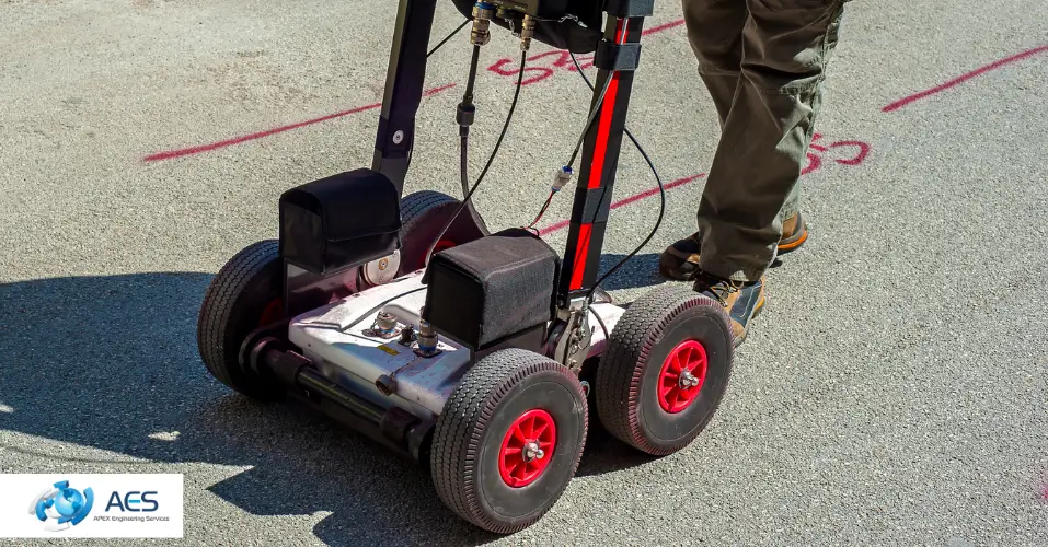
Ground Penetrating Radar is a non-invasive geophysical technique that uses high-frequency electromagnetic waves to image the subsurface. A GPR scanning technology transmitter emits radar pulses into the ground; when these pulses encounter a change in material such as a buried pipe, concrete structure, or rebar, they reflect back to the surface and are captured by a receiver. The reflected signals are then processed to create detailed profiles of what lies below.
The speed and depth of the reflected signals allow experienced surveyors to determine not only the presence of subsurface features but also their depth, orientation, and approximate material composition. Modern systems can detect both metallic and non-metallic utilities, including plastic water pipes and fibre optic cables, making underground utility detection GPR far more comprehensive than traditional electromagnetic methods alone.
AES utilises dual-system surveys, pairing GPR with Electromagnetic Location (EML) technology to maximise detection coverage and minimise the risk of missed assets.
The Limitations of Traditional Utility Detection Methods
Before the widespread adoption of GPR utility mapping, construction teams typically relied on cable and pipe locators that work using electromagnetic induction. While effective for detecting metallic utilities that can be traced or energised, these methods have notable limitations:
- They cannot detect non-conductive materials such as plastic or concrete ducts without a signal-carrying conductor inside.
- They offer limited depth resolution, particularly in congested or geologically complex environments.
- High ambient electromagnetic noise, common near electrical substations or urban infrastructure, can distort readings and reduce accuracy.
- They provide no visual subsurface profile, relying entirely on the auditory signal of the surveyor's equipment.
Non-invasive utility detection using GPR overcomes many of these challenges, making it an essential tool in any professional utility survey toolkit.
How GPR Improves Accuracy in Underground Utility Mapping
Detection of Both Metal and Non-Metal Services
One of the most significant advantages of subsurface utility mapping with GPR is the ability to locate all buried infrastructure, regardless of material. Plastic water mains, HDPE gas pipes, non-metallic drainage systems, and concrete ducting are all detectable, something traditional EML methods simply cannot achieve on their own.
High-Resolution Subsurface Profiles
Modern GPR systems generate detailed two-dimensional and three-dimensional subsurface images. This means AES surveyors can present clients with clear, interpretable data that shows the position, depth, and layout of buried services in a way that is easy to incorporate into construction planning workflows. GPR accuracy in construction has advanced significantly in recent years, with high-frequency antennas now capable of resolving features at centimetre-scale depths.
Performance in High-Noise Environments
Traditional locating equipment often struggles in electrically noisy environments. Our GPR systems are specifically selected for their performance in such conditions, making our construction site GPR surveys reliable even in electrical substations, rail corridors, and dense urban environments where signal interference is common.
Non-Invasive, Zero-Disruption Surveying
Ground Penetrating Radar surveys require no excavation, no intrusion into the ground, and minimal disruption to site operations. This is particularly valuable on live sites, heritage locations, and areas where maintaining surface integrity is a contractual or regulatory requirement.
Compliance with PAS 128
All Apex Engineering Services utility mapping surveys are conducted in line with PAS 128 GPR survey standards, the British Standard for subsurface utility detection and verification. PAS 128 defines clear quality levels for utility mapping, and incorporating GPR is essential to achieving the highest confidence classifications. Our compliance with this standard ensures that the data we produce is defensible, audit-ready, and trusted by engineers, local authorities, and insurers alike.
Apex Engineering Services GPR Services: A Combined Approach for Maximum Accuracy
At Apex Engineering Services, we do not rely on any single technology. Our approach to underground utility detection GPR combines multiple complementary techniques to deliver the most complete picture of the subsurface possible. Our survey toolkit includes:
- Ground Penetrating Radar (GPR): For detecting all buried features, including non-metallic utilities and embedded concrete structures.
- Electromagnetic Location (EML): For tracing conductive services and verifying utility type and ownership.
- Concrete Scanning and Rebar Mapping: For identifying embedded steel reinforcement, post-tension cables, and voids within concrete slabs and walls.
- UAV and 3D Laser Scanning Integration: For complex sites where aerial data and precise surface models are required alongside subsurface mapping.
This multi-technology approach is what sets AES apart. By integrating ground penetrating radar UK surveys with EML and other geophysical tools, we deliver a level of accuracy and confidence that a single-method survey cannot match.
Whether you need a straightforward pre-excavation utility check or a comprehensive PAS 128-compliant subsurface investigation for a major infrastructure project, our team has the expertise and equipment to deliver. Utility locating services UK clients rely on Apex Engineering Services for accurate, timely, and professionally presented data that stands up to scrutiny.
Real-World Applications of GPR Utility Mapping
The versatility of GPR survey UK services means they are applicable across a wide range of industries and project types:
Construction and Pre-Excavation Surveys
Before any ground-breaking activity, accurate knowledge of what is buried is essential. Underground hazard detection using GPR significantly reduces the risk of utility strikes, one of the most common causes of construction delays, unplanned costs, and serious injury on site.
Highways and Infrastructure Projects
Road widening, junction upgrades, and utilities diversions all require precise knowledge of existing buried services. GPR provides this data quickly and without disrupting traffic or pavement.
Structural and Renovation Projects
Before drilling into floors, walls, or ceilings in existing buildings, our concrete scanning and rebar mapping services use GPR scanning technology to locate reinforcement bars, post-tension cables, and embedded conduits, preventing accidental damage and structural compromise.
Utility and Energy Sector Projects
Power companies, water utilities, and telecoms operators rely on GPR utility mapping to verify and update their asset records, supporting network maintenance, upgrades, and new connection works.
High-Noise and Restricted Environments
Electrical substations, rail depots, and other high-noise environments present particular challenges for standard locating equipment. Apex Engineering Services's GPR systems are proven performers in these conditions, making our subsurface utility mapping service the go-to solution for projects in complex operational environments.
Why Choose Apex Engineering Services for GPR Surveys?
With over a decade of experience delivering engineering and surveying solutions for the construction industry, Apex Engineering Services has the credentials, technology, and expertise to handle GPR projects of any scale. Here is what makes us the trusted choice for ground penetrating radar UK surveys:
- Experienced Team: Our surveyors bring specialist knowledge across utility detection, structural scanning, and geotechnical investigation.
- Advanced Technology: We invest in the latest GPR systems and processing software to ensure the highest quality subsurface data.
- PAS 128 Compliance: Every utility survey is conducted to the appropriate PAS 128 quality level, providing clients with traceable, defensible records.
- Combined Survey Approach: GPR paired with EML and other methods ensures maximum detection coverage.
- Flexible Delivery: From overnight single-site surveys to long-term infrastructure programmes, we adapt to the demands of your project.
- UK and Global Reach: Based in the UK but equipped to operate on international projects, Apex Engineering Services brings consistent quality wherever it is needed.
Our mission at Apex Engineering Services is simple: to be a dependable partner in the construction industry, delivering reliable, innovative, and cost-effective subsurface investigation services that give our clients the confidence to proceed safely and efficiently.
Frequently Asked Questions
What is Ground Penetrating Radar and what can it detect?
Ground Penetrating Radar is a non-invasive survey method that uses electromagnetic radar pulses to image the subsurface. It can detect both metallic and non-metallic buried features, including plastic pipes, concrete structures, rebar, voids, and various utility types. When used as part of a GPR survey UK service alongside EML technology, it provides a comprehensive picture of all buried infrastructure.
How accurate is a GPR utility survey?
GPR accuracy depends on several factors, including ground conditions, depth of the target, and the frequency of the antenna used. In favourable conditions, modern GPR systems can locate utilities to within a few centimetres horizontally and provide accurate depth estimations. At Apex Engineering Services, we combine GPR with EML systems to maximise accuracy and minimise the risk of missed assets, ensuring our results meet PAS 128 GPR survey standards.
How does GPR differ from traditional cable and pipe locators?
Traditional electromagnetic locators can only detect metallic or conductive utilities and require a signal to be applied or induced. In contrast, underground utility detection GPR can locate all buried materials regardless of conductivity, providing a visual subsurface profile rather than just an auditory signal. GPR is also more effective in high-noise environments and can detect features at greater depth.
Is a GPR survey compliant with PAS 128?
Yes. GPR is a recognised and recommended technology within the PAS 128 standard for subsurface utility detection. At Apex Engineering Services, all our utility mapping surveys are conducted in accordance with PAS 128, and the use of GPR is integral to achieving higher quality level classifications. Our utility locating services UK deliverables include full documentation that supports PAS 128 compliance and audit requirements.
Can GPR be used inside buildings or on concrete structures?
Absolutely. Concrete scanning is one of the most common applications of GPR technology. Our construction site GPR surveys include detailed scanning of concrete floors, walls, and ceilings to locate rebar, post-tension cables, embedded conduits, and voids. This is essential before drilling, cutting, or coring operations to prevent damage to structural elements or buried services within the slab.
Conclusion
The adoption of Ground Penetrating Radar in underground utility mapping has fundamentally changed the way the construction industry approaches subsurface investigation. By combining high-resolution imaging, the ability to detect non-metallic utilities, and reliable performance in complex environments, ground penetrating radar UK surveys have become an indispensable tool for any project where the safety of workers and the integrity of buried infrastructure must be protected.
At Apex Engineering Services Ltd, we go further than simply deploying technology. Our integrated approach combining GPR with EML, concrete scanning, rebar mapping, and other advanced survey techniques delivers the depth of insight that modern construction projects demand. Our commitment to PAS 128 compliance, technical excellence, and client-focused delivery makes us the partner of choice for professionals who need accurate, actionable subsurface data.
Whether you are planning a major infrastructure project, a targeted utility diversion, or a structural renovation, Apex Engineering Services Ltd has the expertise to support every stage of the process. Get in touch with our team today to find out how our GPR utility mapping and subsurface investigation services can add precision, safety, and value to your next project.