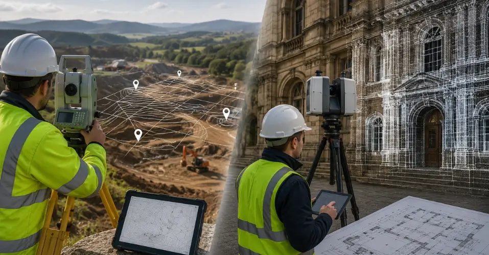
A topographical survey vs measured building survey comparison comes down to one simple question: is your project about the land or about an existing building? A topographical survey maps the ground, levels, and features of a site, while a measured building survey records the exact dimensions of a structure that is already there. Choosing the wrong one can lead to missing information, delayed planning applications, or design work based on incomplete data.
This article explains what each survey covers, when you need one, the other, or both, and how to choose the right survey for your project in the UK.
What Is a Topographical Survey
A topographical survey records the shape and features of a piece of land. It captures ground levels, contours, boundaries, trees, drainage, roads, and any structures on site, giving designers and engineers an accurate picture of the existing conditions before work begins.
Surveyors typically use total stations, GNSS equipment, or drone photogrammetry to collect this data, which is then produced as a site plan or contour model. This type of survey is essential for planning applications, drainage design, access planning, and any project where the shape of the land affects the design.
What Is a Measured Building Survey
A measured building survey focuses on an existing structure rather than the surrounding land. It captures accurate floor plans, elevations, cross sections, and internal layouts of a building, giving architects and engineers a reliable record of what is actually there rather than what old drawings suggest.
These surveys are typically produced using 3D laser scanning, which captures millions of data points and converts them into precise CAD drawings or BIM models. A measured survey of this kind is essential for renovations, extensions, change of use projects, and any scheme where the existing structure needs to be understood before new design work starts.
Topographical Survey vs Measured Building Survey: Key Differences
The two survey types answer different questions, and neither can substitute for the other.
Scope
A topographical survey covers the land, including levels, boundaries, and external features. A measured building survey covers the structure itself, both internally and externally.
Typical Outputs
Topographical surveys produce site plans and contour models. Measured building surveys produce floor plans, elevations, sections, and sometimes BIM models.
Who Uses Each Survey
Civil engineers, planners, and developers rely on topographical surveys for site design and infrastructure work. Architects, heritage consultants, and facilities managers rely on measured building surveys for renovation, restoration, and space planning projects.
Equipment Used
Topographical surveys typically use total stations, GNSS receivers, and drones. Measured building surveys typically use 3D laser scanners, sometimes supported by photogrammetry for detailed elevations.
When You Need a Topographical Survey
A topographical survey is usually required when a project involves the land itself rather than an existing building. Common examples include:
- New build developments on undeveloped or partially developed land
- Planning applications that require accurate site levels and boundaries
- Drainage, access, or landscaping design
- Infrastructure and highway projects
When You Need a Measured Building Survey
A measured building survey is usually required when a project involves changing or understanding an existing structure. Common examples include:
- Renovations, extensions, or internal reconfigurations
- Heritage and listed building documentation
- Change of use projects where existing layouts need verifying
- BIM or digital twin projects requiring an accurate as built model
When You Might Need Both
Many projects involve both an existing building and the surrounding land, particularly redevelopment schemes, change of use projects, or new builds on complex sites. In these cases, a topographical survey and a measured building survey are often commissioned together, giving the design team a complete picture of both the site and any existing structures before design work begins.
Cost and Timeline Considerations
The cost and timeline for each survey depend on the size and complexity of the site or building rather than the survey type itself. A small measured survey of a single dwelling can often be completed in a day, while a large commercial building with complex internal layouts takes longer to capture and process. Topographical surveys follow a similar pattern, with site size, vegetation cover, and the level of detail required all affecting how long the work takes.
Because both survey types rely on similar scanning and positioning technology, commissioning them from the same provider can also streamline delivery. Data from a topographical survey and a measured survey can be tied to the same site datum, making it easier to combine both datasets into a single coordinated model where a project needs it.
How to Decide Which Survey Your Project Needs
If your project is focused on developing land, planning a new structure, or dealing with drainage and access, a topographical survey is the starting point. If your project involves altering, restoring, or better understanding an existing building, a measured building survey is what you need. For projects that combine both elements, commissioning both surveys together avoids gaps in information later in the design process.
Frequently Asked Questions
What is the difference between a topographical survey and a measured building survey?
A topographical survey maps the land, while a measured building survey records the dimensions of an existing structure.
Can one survey replace the other?
No. They answer different questions and cannot substitute for each other on most projects.
Do I need both surveys for a renovation project?
Only if the project also involves external site works, drainage, or landscaping alongside the building changes.
Which survey is required for planning applications?
Most planning applications require a topographical survey to show accurate site levels and boundaries.
How long does each type of survey take?
This depends on the size and complexity of the site or building, but most surveys are completed within a day or two.
Conclusion
Choosing between a topographical survey vs measured building survey depends on whether your project is about the land or the building. Getting this decision right at the start avoids delays, incomplete design information, and costly rework later on. If your project involves both elements, commissioning both surveys together gives your design team everything they need from day one.
At Apex Engineering Services, our topographical survey and measured building survey teams work across the UK to give architects, engineers, and developers accurate data for every stage of a project. To discuss which survey your project needs, get in touch with our team.