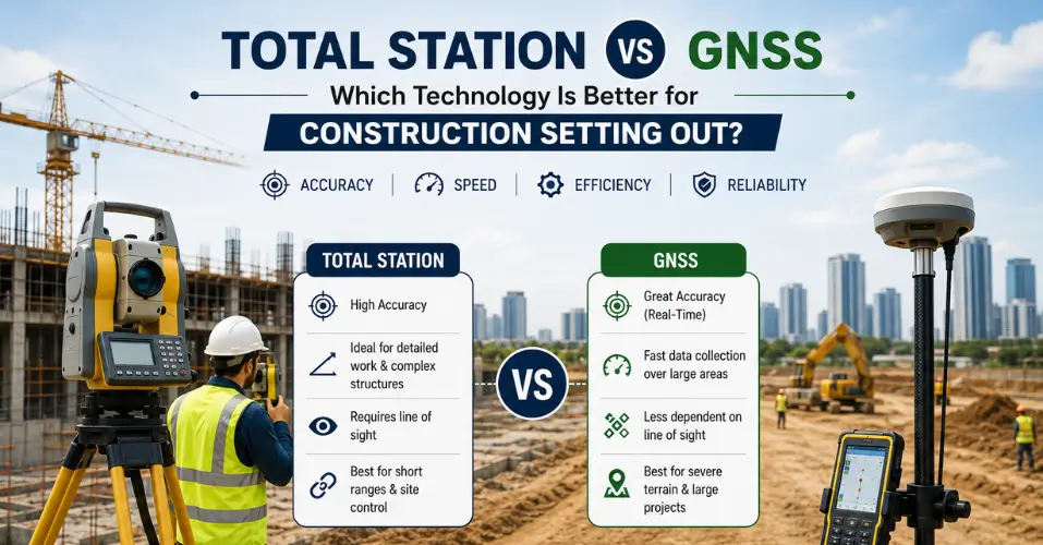
Choosing between a total station and GNSS is one of the most common decisions site engineers face when planning setting out on a construction project. Both instruments measure position accurately, but they work in fundamentally different ways and suit different site conditions. Neither technology is universally better. The right choice depends on the accuracy your project demands, the environment you are working in, and how the site will change as construction progresses.
This guide compares total station vs GNSS setting out directly, so you can decide which construction surveying equipment fits your project.
What Is a Total Station?
A total station is an optical survey instrument that combines a theodolite with an electronic distance meter. It measures horizontal and vertical angles alongside precise distances from a fixed setup point to a target, typically a reflective prism. Because it relies on line of sight rather than satellite signals, a total station delivers highly repeatable, millimetre-level accuracy regardless of what is happening in the sky above the site.
Setting out with a total station involves establishing the instrument over a known control point, then directing it to stake out coordinates loaded from the design drawing. Robotic total stations extend this further, allowing a single engineer to operate the instrument remotely while tracking a prism on the move, without a second person needed to hold the target.
What Is GNSS?
GNSS, or Global Navigation Satellite System, determines position by receiving signals from orbiting satellites. Construction-grade GNSS receivers typically use Real Time Kinematic, or RTK, corrections to reach centimetre-level accuracy in good conditions. A base station or network correction signal refines the raw satellite data, giving the rover a precise fix on its position almost instantly.
GNSS performs best in open areas with a clear, unobstructed view of the sky. Because it does not depend on line of sight to a fixed instrument, a single operator can move quickly across large areas, collecting or setting out points without needing to relocate an instrument between setups.
Total Station vs GNSS Setting Out: Key Differences
The clearest way to compare the two technologies is side by side.
|
Factor |
Total Station |
GNSS |
|
Typical accuracy |
Millimetre level |
Centimetre level with RTK |
|
Line of sight required |
Yes |
No |
|
Performance near buildings or trees |
Unaffected |
Can be degraded or blocked |
|
Speed over large open areas |
Slower, needs multiple setups |
Fast, single operator can cover hectares |
|
Best working environment |
Urban sites, indoors, obstructed areas |
Open sites with clear sky view |
|
Setup requirement |
Requires a known control point |
Requires satellite visibility and corrections |
Total stations win on raw precision and reliability in difficult environments. GNSS wins on speed and coverage across large, open sites. Neither factor makes one technology better overall. It makes them suited to different tasks.
Accuracy: How the Two Technologies Compare
Accuracy is usually the deciding factor for setting out work, and it is worth understanding why the two technologies differ so much in this respect.
A total station measures angles and distances directly from a known point, so its accuracy depends mainly on the quality of the instrument, the calibration of the control network, and operator technique. This makes it consistently capable of millimetre precision, which is why construction setting out, boundary surveys, and as built verification usually rely on a total station wherever tight tolerances matter.
GNSS accuracy depends on a different set of variables, including satellite geometry, the quality of RTK correction data, and how much of the sky is visible from the receiver. In open conditions, GNSS can achieve strong centimetre-level accuracy. Move that same receiver near tall buildings, under tree cover, or into an urban canyon, and the signal quality can drop noticeably, along with the reliability of the fix. This is the main reason GNSS rarely matches a total station for tasks that demand guaranteed millimetre accuracy.
Project Suitability: Choosing the Right Technology
Matching the technology to the site conditions and project type is more useful than asking which instrument is generally superior.
Total stations suit projects where:
- Millimetre accuracy is required, such as structural steel bolt positions or precast element placement
- The site is obstructed by buildings, scaffolding, dense vegetation, or is located indoors
- Setting out points are close together and can be measured efficiently from one setup
- Real-time verification is needed without waiting for satellite corrections
GNSS suits projects where:
- The site is large and open, such as highways, pipelines, or greenfield infrastructure works
- Points are spread far apart and a single instrument setup would be inefficient
- Speed of coverage matters more than absolute precision
- Site conditions change frequently, since GNSS does not depend on fixed control points that earthworks might destroy
Many contractors use both technologies on the same project, applying GNSS for broad site control and rapid topographical coverage, then switching to a total station for the detailed, high-tolerance setting out that structural elements require.
A typical example is a mixed use development with a large open car park area alongside a multi storey building core. GNSS can quickly establish levels and boundary points across the open car park, where sky visibility is good and speed matters more than millimetre precision. Once work moves to the building core, where steel columns, lift shafts, and cladding fixings all carry tight tolerances, the same site engineering team switches to a total station to guarantee the accuracy those elements demand. Treating the two technologies as complementary, rather than competing, tends to produce the most efficient and accurate outcome across a full project.
Common Mistakes When Choosing Between Total Station and GNSS
- Relying on GNSS indoors or in dense urban areas. Signal quality drops sharply in these environments, and positions can become unreliable without an operator realising it.
- Using a total station without a verified control network. A total station is only as accurate as the point it is set up from, so an unchecked control point undermines the whole survey.
- Assuming one technology suits an entire project. Large sites often benefit from combining both, rather than forcing a single instrument to handle every task.
- Skipping site condition checks before choosing equipment. A short assessment of sky visibility, obstructions, and required tolerances usually makes the right choice obvious before work begins.
Workflow and Efficiency on Site
Beyond raw accuracy, the two technologies also differ in how they fit into a typical setting out workflow.
A total station setup takes longer than picking up a GNSS rover, since the instrument needs to be positioned over a known control point and oriented before any points can be staked out. Once set up, however, a total station can measure a large number of nearby points quickly and repeatably from that single position, which suits detailed structural setting out where many closely spaced points need marking.
GNSS has almost no setup time beyond powering on the receiver and confirming a fix, which makes it efficient for covering large distances between points. The tradeoff is that this speed depends entirely on maintaining a good satellite fix throughout, so an engineer moving in and out of shadowed areas may see productivity drop as the receiver reacquires signal.
Robotic total stations narrow this gap by allowing one engineer to operate the instrument and hold the prism, removing the need for a second team member. This makes robotic total stations a practical middle ground on sites where obstructions rule out GNSS but productivity still matters.
Cost and Training Considerations
Equipment cost and the training required to use it properly also influence which technology a project relies on day to day.
Total stations and their accessories represent a significant capital investment, and operators need training to set up control networks correctly, since an error at that stage carries through every subsequent measurement. GNSS equipment can also be costly, particularly systems with RTK correction subscriptions, but the learning curve for basic point collection is often shorter than mastering total station control work.
For most contractors, the more practical question is not which piece of equipment to buy, but which specialist provider to work with. Site engineering teams that maintain both types of equipment, and the calibration and training that go with them, can apply whichever technology suits each task without the contractor needing to invest in either directly.
How AES Combines Both Technologies for Accurate Setting Out
At Apex Engineering Services, our setting out services draw on both robotic total stations and GNSS equipment, selecting the right instrument for each stage of a project rather than defaulting to one technology throughout. This approach is supported by dedicated survey control services, which establish the primary and secondary reference points that both total station and GNSS work depend on. For projects that also require rapid, repeatable layout printing, our HP SitePrint service adds a further layer of accuracy once setting out data has been established.
FAQs
Is a total station more accurate than GNSS?
Yes, generally. A total station typically achieves millimetre accuracy, while GNSS with RTK reaches centimetre-level accuracy in good conditions.
Can GNSS be used indoors?
No. GNSS relies on satellite signals, so it does not work reliably indoors or in heavily obstructed areas.
Do construction projects need both technologies?
Often, yes. Many projects use GNSS for broad coverage and a total station for detailed, high-tolerance setting out.
Why does GNSS accuracy vary between sites?
GNSS accuracy depends on satellite visibility, correction quality, and obstructions such as buildings or trees near the receiver.
Which technology suits small urban construction sites?
Total stations usually suit urban sites better, since buildings and obstructions can disrupt GNSS signal quality.
Conclusion
Total station vs GNSS setting out is not a question with a single winner. Total stations remain the stronger choice wherever millimetre accuracy and obstructed site conditions demand it, while GNSS offers speed and efficiency across large, open areas. The most reliable construction surveying equipment strategy is usually a combination of both, applied according to what each stage of the project actually requires. Working with a site engineering team that understands the strengths and limits of each technology gives your project the accuracy it needs without paying for precision you do not.