Climate is not the same as it was in 2020 or 2022; it is changing drastically with the passage of time. Every year, the rain will be heavy, and the chances of floods will increase.
In that case, if someone wants a building with a view of a beautiful lake, but doesn’t know whether it is safe or not, what should they do?
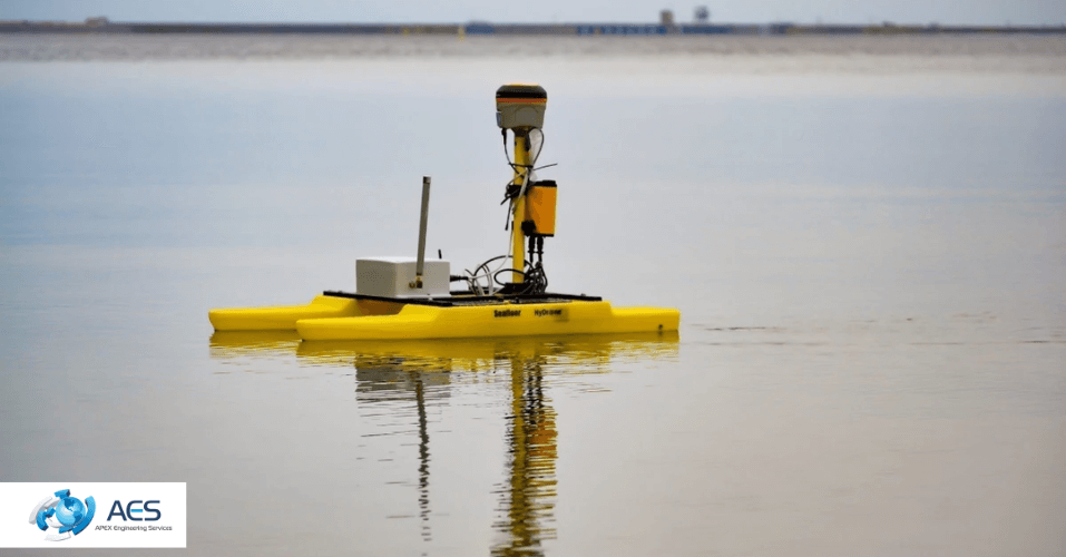
That is where the importance of a hydrographic survey cannot be neglected. The experts of Apex Engineering Services use advanced gadgets to evaluate the risks of floods. They properly do the inspection and give accurate data on:
- Water depths
- Geographical features
- Natural and artificial navigational hazards (underwater cables or pipelines).
So, this blog will be your project saver if you are planning to build near water.
Understanding the Depths: What Is a Hydrographic Survey in the UK?
Before directly indulging in how a hydrographic survey is connected to climate change, it is critical to understand what it is.
The science of measuring and charting underwater features is known as hydrographic surveying. It records information about the shape of the seafloor, the depth of the water, and any hidden obstacles beneath the surface.
Apex Engineering Services conducts this survey through sonar, which is an advanced seabed mapping technology. Their engineers generate sound waves in water through sonar, then calculate the time taken by those sound waves to bounce back after hitting the bottom of the water.
Mapping Change: How Hydrographic Surveys Track Sea-Level Rise
The rise in sea level is not consistent. Not everywhere does it ascend in the same way. While some locations affect more quickly, others remain stable for years before a sudden rise. Apex Engineering Services' hydrographic surveys provide accurate information, through which you can identify these threats.
Their sonar systems efficiently measure the depth of the water. However, the variations in these data over time show the extent of the sea level shift. According to the 2025 BBC News, they warned that there would be heavy rain across the UK, and some local areas might face floods because of it. Knowing about the location beforehand will let property owners make a decision.
These surveys explain how tides and currents respond to climate change. So, you wouldn't be able to see what's actually going on underneath the surface without these surveys.
Hidden Warnings Beneath the Waves
The integrity of hydrographic data is what makes it so unique. It presents reality, even when it is quite shocking or disturbing. Submerged hazards and changing sediments are signs of potential dangers that are revealed by AES underwater surveys. For instance, rising floods can damage the barrier land and expose weak spots in riverbanks.
These underwater maps help in forecasting water overflow locations during severe weather. Before a calamity occurs, engineers can use this information to support infrastructure projects. It has evolved from a simple navigational aid to a protector of the coastline.
Each scan from advanced seabed mapping technology serves as a warning. Each map contour serves as a hint. When taken as a whole, they suggest that water management will eventually be as crucial as food or energy security.
Technology Gives Climate Awareness
The engineers of AES use technology to inform clients whether the project is near a fishing lake or a pond. They use GPS with advanced sonar for their hydrographic surveys. Every seabed reading is guaranteed to be exact because of this tech equipment coordination.
They conduct surveys to better understand natural systems in addition to ports, bridges, and offshore developments. Their data helps environmental scientists in modelling coastal ecosystems by analysing the movement of sediments, currents, and tides.
How Engineers Use Sonar to Know The Depth of a Waterbody?
Sonar consists of a transmitter, a transducer, and a receiver. Through the transmitter, engineers create a pulse in the water, and that pulse is converted into a sound wave through a transducer.
Furthermore, that sound wave travels in the water, and when it hits the bottom of the surface, it bounces back to the transducer, which converts it into an electric pulse again. The overall time is captured through the receiver, and that is how the experts of Apex Engineering Services get accurate data on the depth of a lake, river, or any seabed.
Most importantly, they also use single and multi-beam sonar so that everything will be planned properly according to the data.
From Depths to Decisions: Turning Data Into Climate Insight
Underwater data collection is only half the story. The usage of the data is what gives hydrographic surveys their value. Apex Engineering Services creates graphic 2D and 3D maps from sonar data. These pictures serve as tools for making decisions in addition to being attractive visuals.
Hence, they are used by environmental consultants, engineers, and builders to identify which area will face the most damage.
What are the questions that people have for Apex Engineering Services?
What is a hydrographic survey, and why is it important?
A hydrographic survey is a study of what lies beneath the water’s surface. It measures the depth, shape, and features of the seabed using sonar and GPS. This information helps scientists and engineers understand how oceans, rivers, and lakes are changing. It’s important because it shows how rising sea levels, erosion, and sediment movement are affecting the UK’s coasts and waterways.
How do hydrographic surveys help track sea-level rise in the UK?
Hydrographic surveys record detailed measurements of water depth over time. When Apex Engineering Services repeats these surveys, small changes in depth reveal how sea levels are rising or shifting. This data helps scientists see which areas of the UK are most at risk from flooding, coastal erosion, or land loss caused by climate change.
What technology does Apex Engineering Services use in a hydrographic survey in the UK?
Apex Engineering Services uses advanced sonar systems, both single-beam and multi-beam, along with GPS positioning. These tools send sound waves underwater and measure how they bounce back, creating accurate 2D and 3D maps of the seabed. The technology ensures precise results that engineers and environmental experts can rely on for planning and protection work.
How do hydrographic surveys support climate change planning?
The data collected in hydrographic surveys helps shape smart climate strategies. By knowing exactly how coastlines and riverbeds are changing, it helps builders and environmental consultants to make a proper decision. In short, hydrographic data turns hidden underwater changes into clear action plans for the future.
What do hydrographic surveys reveal about the UK’s climate future?
These surveys reveal that the UK’s coastal and river systems are already responding to climate change. They show areas where sea levels are rising, where erosion is increasing, and where sediment is shifting. This knowledge helps predict future risks and gives people who are planning to build near water a chance to adapt before problems become crises.
Conclusion
Our future lies in the depths of the sea. The experts of Apex Engineering Services are helping us interpret that future contour by contour through a hydrographic survey in the UK.
These results are more than simply chart data. They are warnings, lessons, and opportunities. They advise clients on where to erect, where to defend, and where to withdraw. So, reach out to Apex Engineering Services because beneath the seas is the key to the UK's climate destiny.